


 76
76

BU Score
Strong
Russian Topo Maps


✍️ bumetric analysis
“
Russian Topo Maps is an Android app from ATLOGIS Geoinformatics GmbH & Co. KG in the Maps & Navigation category, currently rated 4.7★ across 67,526 ratings. Initial signal reads as mixed reviews: supporters praise core features while critics cite stability and value gaps.
Our BU Score puts it at 76: Strong (healthy traction). For a Maps & Navigation app, that means healthy traction.
Track changes month-over-month in the Performance section below: live snapshot history and revenue forecast included.
📊 Performance Tracking LIVE
Loading…
Rating
—
Reviews
—
Forecast Revenue / mo
—
Snapshots tracked
0
since first record
Range:
💰 Forecast Revenue / mo
MODELRevenue forecast computed from BU's 234 trigger model on each snapshot. Calibrated against ground-truth from 58 verified-revenue apps.
🔬Forecast Breakdown — Why This Estimate?Top 3 of 3 triggers
Our ML model uses 200+ signals from public data. These are the most influential for this app:
| Mid install base (67,526 ratings)METRIC | +$5,500 | |
| Excellent rating (4.7★)METRIC | +$2,200 | |
| Ad-supported / freemiumMETRIC | +$600 |
METRIC = structural app data · REVIEW = mined from user reviews · ✓ VERIFIED = Stripe-verified anchor (TrustMRR)
📈 Reviews Growth
LIVECumulative review count from first BU snapshot. Each point = a tracked update.
⭐ Rating Trend
LIVEAverage rating evolution. Updates with each new review batch.
🗓️ Snapshot Timeline
HISTORYEach bar shows a tracked update and the metric delta from the previous snapshot.
App Specs
🔐 Own this app? Claim & verify MRR →🔖 v7.8.8 free🔄 updated 2mo ago📂 Maps & Navigation💰 Free
📝 About this app
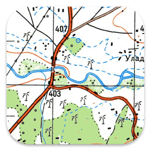
Offroad navigation app with worldwide topographic maps (mainly Russian general staff maps). There are also many other map layers with up-to-date and detailed maps or aerial photos.
Even though many of the Russian general staff maps date back to the 1980s, they are still among the best topo maps available for many regions in Africa and Asia, especially if you are looking for remote tracks or old infrastructure. All maps are also labelled in English.
Map data can be downloaded so that the application can also be used without internet reception. No user data is collected by the app!
Selectable map layers (worldwide):
• Topo maps (worldwide coverage 1:100,000 - 1:200,000) Russian General Staff maps - Genshtab
• GGC Gosgiscentr Topo maps Russia 1:25,000 - 1:200,000
• Yandex Maps: Satellite images, road map. (Online use only!)
• AtloMaps OSM Maps with LiDAR hillshading (worldwide)
• CyclOSM maps for cycling routes
• Google Maps: Satellite images, road and terrain maps. (Online use only!)
• Bing Maps: Satellite images and street map. (Online use only !)
• ESRI Maps: Satellite images, street and terrain map. (Online use only !)
All maps can be created as overlays and compared with each other using a transparency slider.
Enhance maps with additional overlays:
• Hiking, cycling, MTB, and winter sports routes worldwide
• 10 m contour lines worldwide
• Hillshade overlay worldwide
• OpenSeaMap
This app offers all functions for comprehensive outdoor navigation:
• Download of maps for OFFLINE operation (except Google, Bing & Yandex Maps)
• Create waypoints
• GoTo waypoint navigation
• Create and navigate routes (with automatic route calculation based on OpenStreetMaps)
• Track recording (evaluation with speed and altitude profile)
• Freely configurable data fields in the map view (e.g. speed, altitude)
• Tripmaster with fields for daily kilometres, average, distance, compass, etc.
• GPX/KML/KMZ import export
• Search function (locations, POIs, street names)
• Waypoint/track sharing (via e-mail, WhatsApp, ...)
• Measurement of paths and areas
• UMTS/MGRS GRID
Other maps can be imported in common formats:
• GeoPDF
• GeoTiff
• MBTiles
• Ozi (Oziexplorer OZF2 & OZF3)
• Online map services can be integrated as WMS servers or XYZ tile servers.
• OpenStreetMap maps can also be downloaded country by country in space-saving vector format!
LIMITATIONS OF THIS FREE VERSION:
• Ads
• Max. 10 Waypoints
• Max. 5 Tracks
• No import/export of waypoints/tracks/routes
• No import of maps (WMS, GeoTiff, GeoPDF, MBTiles)
• No Cache download for offline use
• No Local City DB (Offline Search)
• No Route navigation
For questions please contact support@atlogis.com
Profile & Insights
Everything we know — and don't — about this app and its company.
Identification
- App name
- Russian Topo Maps
- Developer
- ATLOGIS Geoinformatics GmbH & Co. KG
- Bundle ID
- com.atlogis.sovietmaps.free
- App Store URL
- Open in App Store
- Category
- Maps & Navigation
- Content rating
- Not found
- Languages
- Not found
Company
- Website
- Not found
- Tagline
- Not found
- Description
- Not found
- Founded
- Not found
- HQ / Address
- Not found
- Employees
- Not found
- Logo
- Not found
Revenue
- Verified revenue / mo
- Not found
- AI revenue estimate / mo
- Not found
- AI annual estimate
- Not found
- ML model estimate / mo
- $2.1K/mo
- Top-grossing rank
- Not found
- All-time revenue
- Not found
- Pricing
- Not found
Founder
- Name
- Not found
- X / Twitter
- Not found
- Not found
- GitHub
- Not found
- X followers
- Not found
- Public statements
- Not found
Funding
- Total raised
- Not found
- Last round
- Not found
- Investors
- Not found
- Crunchbase
- Not found
- AngelList
- Not found
Press & Links
- Articles found
- Not found
- Listed on
- Not found
- Blog
- Not found
- Press / News
- Not found
Contacts & Socials
- Socials
- Not found
- Not found
- Phone
- Not found
- Contact page
- Not found
- About page
- Not found
Profile is built from iTunes Lookup + developer site scrape + ML revenue model. Empty fields show "Not found" — additional sources (Crunchbase, X, IndieHackers, Acquire.com) coming.
More by ATLOGIS Geoinformatics GmbH & Co. KG
View all →


Full revenue analysis
Read the article-style breakdown for Russian Topo Maps: category rank, percentile, growth signal, comparable apps, and how the forecast is calibrated against verified-MRR anchors in this niche.