What CartoDruid - GIS offline tool actually does (from store listing)
CartoDruid is a GIS application developed by the Instituto Tecnológico Agrario de Castilla y León (ITACyL), designed as a tool to support fieldwork. It addresses the challenge of offline editing of georeferenced information.
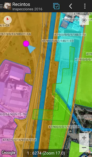
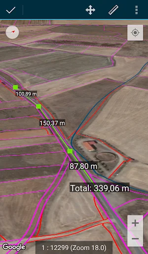
In many field areas with insufficient mobile coverage, CartoDruid provides a reliable solution by enabling visualization of raster and vectorial layers stored on the device. It allows the creation of new geometries (entities) by drawing them directly on the screen or usin…
CartoDruid is a GIS application developed by the Instituto Tecnológico Agrario de Castilla y León (ITACyL), designed as a tool to support fieldwork. It addresses the challenge of offline editing of georeferenced information.
In many field areas with insufficient mobile coverage, CartoDruid provides a reliable solution by enabling visualization of raster and vectorial layers stored on the device. It allows the creation of new geometries (entities) by drawing them directly on the screen or using embedded or external GPS.
CartoDruid is user-friendly and doesn’t require previous GIS knowledge, making it easy to configure and use for anyone managing fieldwork information. Data generated can be exported for use in external applications.
Features of CartoDruid include:
Visualization of online Google Maps.
Usage of vectorial cartography in a SpatiaLite database.
Raster imagery support from a RasterLite database.
Online WMS services consumption.
Creation and configuration of new layers on the device.
Filtering, symbologies, labeling, searching, and identification forms based on SQL queries.
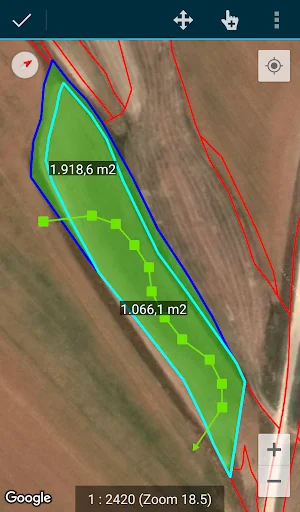
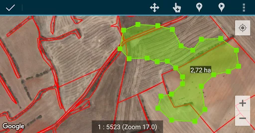
Editing attributes and manual drawing of geometries.
GPS-based drawing and editing of geometries.
Advanced geometry editing tools.
Data saving features, including georeferenced data and associating pictures to entities.
Additional tools like SIGPAC search, measurement tools, navigation aids, bookmarks management.
Import and export functionalities in multiple formats.
TOC management and SHP file support as an experimental feature.
Layer operation controls.
CartoDruid uses background location services for creating features based on location tracking. User location is only used for creating geometry vertices or map positioning, with data stored locally and not sent outside the device. Project folder deletion allows for easy data removal.
For a complete list of features, downloadable examples, and starting guides, visit www.cartodruid.es.
Comparable Android apps
The five apps in Tools with the closest revenue to CartoDruid - GIS offline tool. Click any to see its detail page.
Each forecast combines App Store rating, ratings count, monetisation model, pricing tier, IAP signals and ad-supported flag.
The base estimate is then multiplied by a per-category scaling factor learned from apps with founder-verified MRR.
Every number on this page comes from public APIs and bumetric's own snapshot history.
Full methodology covers input variables, accuracy bands per category and how we treat apps without comparable anchors.
See also the live data on CartoDruid - GIS offline tool's tracker page for current rating, reviews and snapshot timeline.
Building something similar? Get a free AI audit with $-revenue forecasts for every recommendation.
 Rezultate Loto 6 49 - Romania
 Touch Screen Test & Repair
 DEN Set Top Box Remote
 Traccar Client
 GPS Aid - Fix GPS Problems