What EasyCockpit GPS Moving Map actually does (from store listing)
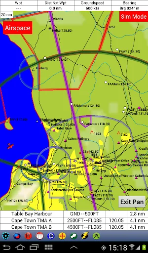
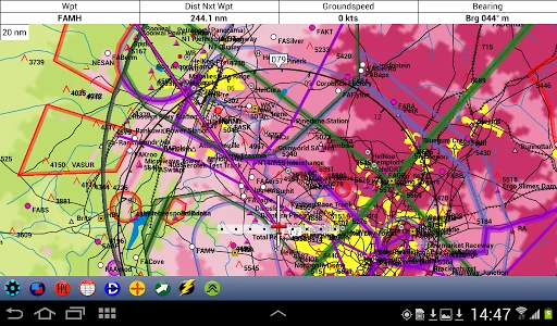
EasyCockpit is an aviation GPS moving map application for Southern Africa running on Android mobile devices. This aviation navigation tool comes with many features and is a Must in the cockpit to not only have latest information at your fingertips but also to greatly enhance your situational awareness and improve safety.
Features include:
- Full colour moving map which can be used in Track Up or North Up mode
- Extensive airfield information including licensed, unlicensed and microlight …
EasyCockpit is an aviation GPS moving map application for Southern Africa running on Android mobile devices. This aviation navigation tool comes with many features and is a Must in the cockpit to not only have latest information at your fingertips but also to greatly enhance your situational awareness and improve safety.
Features include:
- Full colour moving map which can be used in Track Up or North Up mode
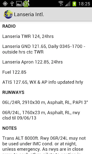
- Extensive airfield information including licensed, unlicensed and microlight airfields, helipads
- IFR and VFR Reporting points
- Special Rules Areas and VFR routings
- Airspace Information, updated
- Direct-To, Move To Function
- Tap on any point on the map and it shows distance, bearing and ETA. Or insert your own Waypoint
- Flight Log displays distance to next waypoint, ground speed, desired track, ETE and ETA, as well as current position in relation to VFR points for easy position reporting
- Flight Planning : Airspace Intersections and Abeam Waypoints can be inserted (flight plans can also be imported from EasyPlan)
- User Waypoints (can also be imported from EasyPlan)
- E6B Flight Calculator
- Terrain awareness, the display can be set to show ground elevation or Aircraft relative to ground, warning of high ground in a different colour shading.
- Aircraft details and Basic Weight&Balance
- HSI Needle
- RMI Needles and OBI Radials
- Airspace, Obstacle and Terrain Warnings
- A Notepad to write quick notes on the screen
- EasyWeather, a great safety feature (subject to subscription and internet connection in flight) to overlay wind forecasts at different flight levels, and actual radar and satellite images to show thunderstorms (South Africa only)
EasyCockpit can be installed as a free trial app with limited information. In order to obtain the full data, please email AviationDirect at info@aviationdirect.co.za to obtain pricing and payment details for the full version.
Comparable Android apps
The five apps in Tools with the closest revenue to EasyCockpit GPS Moving Map. Click any to see its detail page.
Each forecast combines App Store rating, ratings count, monetisation model, pricing tier, IAP signals and ad-supported flag.
The base estimate is then multiplied by a per-category scaling factor learned from apps with founder-verified MRR.
Every number on this page comes from public APIs and Bumetric's own snapshot history.
Full methodology covers input variables, accuracy bands per category and how we treat apps without comparable anchors.
See also the live data on EasyCockpit GPS Moving Map's tracker page for current rating, reviews and snapshot timeline.
Building something similar? Get a free AI audit with $-revenue forecasts for every recommendation.


 VoIP Recorder & Screen Recorde
 DocSearch+ Search File Content
 GridCarbon
 노재팬, 노노재팬, 일본불매앱, 일본불매목록, 일본불매
 Alarm Clock Electric Dawn