What GPS Air Navigator actually does (from store listing)
GPS Air Navigator is an application for VFR Air Navigation :: Air Nav.
Follow us on https://www.facebook.com/gpsairnavigator!
Main features:
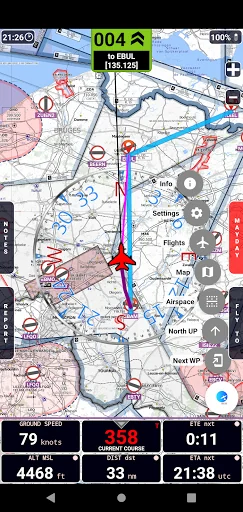
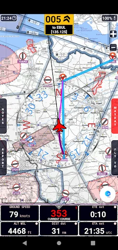
• real-time GPS moving map
• graphical visualization of country air space
• navigation with True or Magnetic North
• High Quality VFR Aeronautical Charts (from Flyermaps.com) for Portugal, Spain, Argentina, Chile, Colombia, Iceland, Uruguay and Venezuela
• free OpenStreetMap maps for all countries
• USA Sectional VFR Charts (generated from FAA V…
GPS Air Navigator is an application for VFR Air Navigation :: Air Nav.
Follow us on https://www.facebook.com/gpsairnavigator!
Main features:
• real-time GPS moving map
• graphical visualization of country air space
• navigation with True or Magnetic North
• High Quality VFR Aeronautical Charts (from Flyermaps.com) for Portugal, Spain, Argentina, Chile, Colombia, Iceland, Uruguay and Venezuela
• free OpenStreetMap maps for all countries
• USA Sectional VFR Charts (generated from FAA VFR Raster Charts)
• WAC and REA Charts from Brazil (thanks to DECEA-Brazil)
• free OpenFlightMaps Charts from Netherlands, Poland, Croatia, Czech Republic, Belgium, Germany, Denmark, Sweden, Bulgaria, Hungary, Slovenia, Austria, Romania and Switzerland (thanks to the Openflightmaps Association)
• airspace information for Portugal with daily updates (integrated with FuaFlex service - www.cavok.pt)
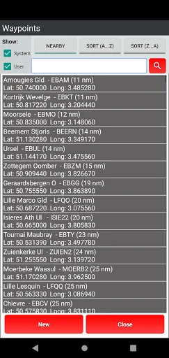
• database with more than 56.000 system waypoints
• create and manage your own user waypoints
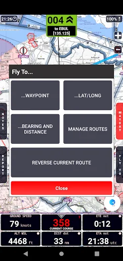
• create and manage your routes and legs
• MAYDAY button: send an automatic SMS with current location (only in devices that support this feature) and activation of a route to the nearest waypoint
• Course with two navigation modes: a) visualization of the course you have to follow to reach the next waypoint or; b) visualization of how many degrees you have to turn to reach the next waypoint, while the arrow shows in which direction the point is in relation to the direction of your flight
• show real-time flight tracks
• save flight tracks to a GPX file for offline processing (visualize in specific apps or inside the GPS Air Navigator)
• visualize your flight stats and share them on Facebook, e-mail, Instagram and so on
• only one licence needed for all your Android devices
After install, you can try the app with the following limitations:
• you can save only two user waypoints;
• the app closes after 15 minutes of usage.
If you like GPS Air Navigator, you can buy a licence using the button Buy inside the app, to use it without limitations.
Enjoy GPS Air Navigator!
Comparable Android apps
The five apps in Maps & Navigation with the closest revenue to GPS Air Navigator. Click any to see its detail page.
Each forecast combines App Store rating, ratings count, monetisation model, pricing tier, IAP signals and ad-supported flag.
The base estimate is then multiplied by a per-category scaling factor learned from apps with founder-verified MRR.
Every number on this page comes from public APIs and bumetric's own snapshot history.
Full methodology covers input variables, accuracy bands per category and how we treat apps without comparable anchors.
See also the live data on GPS Air Navigator's tracker page for current rating, reviews and snapshot timeline.
Building something similar? Get a free AI audit with $-revenue forecasts for every recommendation.
 Rastreamento Veicular
 Regrid Property App
 Taxijakt
 Consulta Saldo Transmilenio
 Chrono – tickets and trips