What Hiking Trail HK actually does (from store listing)
Hiking Trail HK is a Hong Kong hiking mobile app.
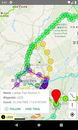
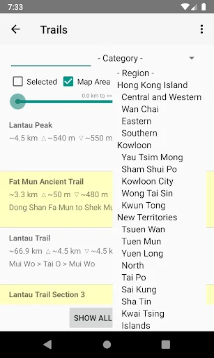
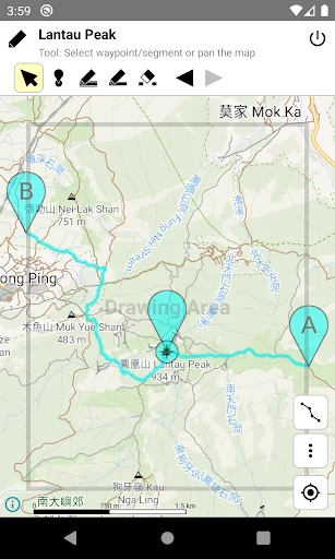
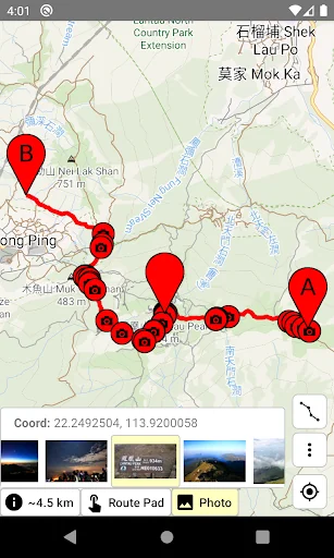
The Android version provides offline map and over 100 hiking trails in HK, and supporting route drawing, route sharing, route length/gain/loss calculation, time estimation, GPS location, compass, track logging, deviation alert, and etc.
The Wear OS version provides offline map in HK, and supporting route editing, route length/gain/loss calculation, time estimation, GPS location, compass, track logging, deviation alert, and etc. Due to the l…
The Android version provides offline map and over 100 hiking trails in HK, and supporting route drawing, route sharing, route length/gain/loss calculation, time estimation, GPS location, compass, track logging, deviation alert, and etc.
The Wear OS version provides offline map in HK, and supporting route editing, route length/gain/loss calculation, time estimation, GPS location, compass, track logging, deviation alert, and etc. Due to the limited screen size, the Wear OS version does not have built-in trails. Users need to transfer routes from a phone, or create/edit routes in the watch directly. All functions work without phone connection, except route transfer.
Before hiking, you can use the route drawing function to plan the route, and use the elevation profile to infer its difficulty, and estimate the time needed. During hiking, offline map is always available even if there is no data connection, and route deviation alert function can prevent you from getting lost.
You can pay for one-time purchase or annual subscription to unlock the trial features or remove the ads in the app and the website.
About Data safety:
• We will collect Purchase history.
• Google Mobile Ads SDK will collect Approximate location, App interactions, Diagnostics, Device or other IDs. This does not apply to paid users.
Comparable Android apps
The five apps in Travel & Local with the closest revenue to Hiking Trail HK. Click any to see its detail page.
Each forecast combines App Store rating, ratings count, monetisation model, pricing tier, IAP signals and ad-supported flag.
The base estimate is then multiplied by a per-category scaling factor learned from apps with founder-verified MRR.
Every number on this page comes from public APIs and bumetric's own snapshot history.
Full methodology covers input variables, accuracy bands per category and how we treat apps without comparable anchors.
See also the live data on Hiking Trail HK's tracker page for current rating, reviews and snapshot timeline.
Building something similar? Get a free AI audit with $-revenue forecasts for every recommendation.

 Ben Gurion (TLV) Airport
 Translator
 airasia ride Driver
 Citilink
 ITAKA - Holidays, Travel