Android app
from Marothia Techs
· Maps & Navigation
ML forecast★ 4.0 · 15KFree
~155/mo
ML revenue forecast.
Calibrated against 14173 apps in this category.
Confidence band
±15%
High — many comparable apps with verified data
At a glance
Tracks close to the Android app category median (180/mo).
Ranks #8,521 of 14,173 in Maps & Navigation (top 60.1% by revenue).
Launched Aug 13, 2020 · last updated Apr 25, 2026.
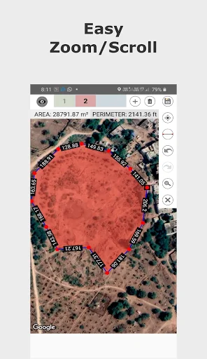
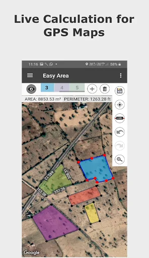
What the app looks like
Live screenshots from the Play Store, captured by our snapshot worker. Tap any image to enlarge.
Easy Area : Land Area Measure's revenue trajectory
Forecast revenue from snapshot history. Last 1 months.
Where Easy Area : Land Area Measure sits in Maps & Navigation
Revenue distribution of 14173 comparable apps. Easy Area : Land Area Measure highlighted.
Easy Area : Land Area Measure vs comparable apps
Revenue trajectory side-by-side. Bold = Easy Area : Land Area Measure, ghosted = peers.
App spec
Version
5.0.4
Last update
Apr 25, 2026
Launched
Aug 13, 2020
Price
Free
Monetization
Free
What Easy Area : Land Area Measure actually does (from store listing)
Easy Area is an area calculator app for measuring Land Area, distance and perimeters on Map or Images in the easiest way. There is an inbuilt Unit Converter for measuring areas and distances in various Indian Land Units
There are two ways to create measurements:
1) <b>Using Maps</b> - You can search the location of your land/field or can find Current location and place border of the region for which area or distance has to be calculated.
- In the maps, you can find the area with zero …
Easy Area is an area calculator app for measuring Land Area, distance and perimeters on Map or Images in the easiest way. There is an inbuilt Unit Converter for measuring areas and distances in various Indian Land Units
There are two ways to create measurements:
1) Using Maps - You can search the location of your land/field or can find Current location and place border of the region for which area or distance has to be calculated.
- In the maps, you can find the area with zero knowledge of any prior measurements.
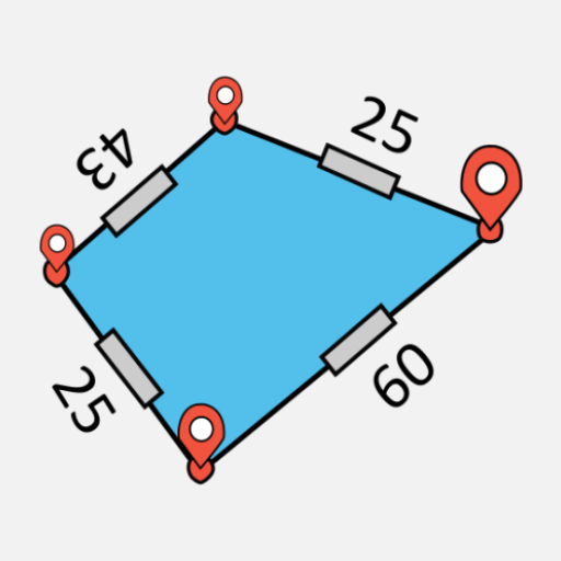
2) Importing Photo - You can import a photo of land, field or any other structure of randomly shaped polygon. Then simply draw over the imported photo to do the measurements. You need to provide the distance for the first line created to set the scale ratio for the image.
- This feature can be used when you have distance measurements of your land boundaries done by self or by regional Patvari (Government Accountant) and require to calculate the area for those measurements.
- Simply create a rough sketch and put the measured lengths for boundaries to get the area calculated at real time.
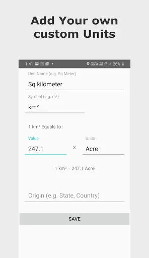
- The calculated area can be converted to any Unit. The Unit converter has all the Imperial Units, Metric Units and also includes major Indian Units used for land records in different states.
Awesome Features:
- 100% Accuracy of the areas calculated using Coordinate and Spherical geometry.
- Displays point to point distances for each line created on the map.
- Manual distances. You can input land border measurements manually. Tap on the distance label of any line to manually change the length of that line. Currently available only while measuring on photos.
- Multiple Layers for measuring multiple areas on same map.
- Save and load calculated measurements.
- Sharing Area link You can share the link to your saved area. User having the link can view update the area over the link.
- Infinite zooming and scrolling of the map with standard gestures.
- Easy tools to create, update, delete points on map.
- Single tap to add new point.
- Tap to select a Point, drag and drop the selected point to easily change position.
- Double tap on any line to add new point at that position.
- Separate Area and Distance Measuring Units with instant calculation.
Major India Units Included are as follows:
- Bigha
- Biswa
- Aankadam
- Shatak
- Perch
- Rod
- Vaar (Gujarat)
- hectare
- Acre
- Are
- Guntha
- Marla
- Cent
- ground and many more..
Comparable Android apps
The five apps in Maps & Navigation with the closest revenue to Easy Area : Land Area Measure. Click any to see its detail page.
Each forecast combines App Store rating, ratings count, monetisation model, pricing tier, IAP signals and ad-supported flag.
The base estimate is then multiplied by a per-category scaling factor learned from apps with founder-verified MRR.
Every number on this page comes from public APIs and bumetric's own snapshot history.
Full methodology covers input variables, accuracy bands per category and how we treat apps without comparable anchors.
See also the live data on Easy Area : Land Area Measure's tracker page for current rating, reviews and snapshot timeline.
Building something similar? Get a free AI audit with $-revenue forecasts for every recommendation.
 MyRide: Ben Franklin Transit
 Und'é Kabes Ta?
 대구버스 스마트
 Buses Magazine
 창원버스 - 다크테마지원