ML revenue forecast.
Calibrated against 77129 apps in this category.
Confidence band
±15%
High — many comparable apps with verified data
At a glance
Earns 1.51× more than the category median (189/mo).
Ranks #22,902 of 77,129 in Tools (top 29.7% by revenue).
Launched Jul 08, 2013 · last updated Feb 27, 2024.
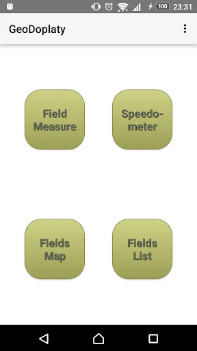
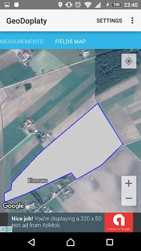
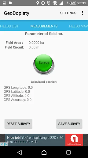
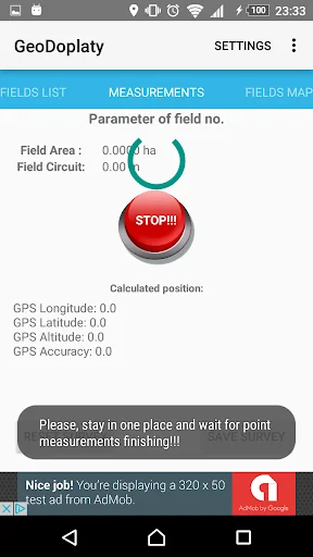
What the app looks like
Live screenshots from the Play Store, captured by our snapshot worker. Tap any image to enlarge.
Land Parcels Areas Calculator's revenue trajectory
Forecast revenue from snapshot history. Last 1 months.
Where Land Parcels Areas Calculator sits in Tools
Revenue distribution of 77129 comparable apps. Land Parcels Areas Calculator highlighted.
Land Parcels Areas Calculator vs comparable apps
Revenue trajectory side-by-side. Bold = Land Parcels Areas Calculator, ghosted = peers.
App spec
Version
Varies with device
Last update
Feb 27, 2024
Launched
Jul 08, 2013
Price
Free
Monetization
Free
What Land Parcels Areas Calculator actually does (from store listing)
LAND PARCELS GPS AREA (GeoDopłaty) FREE VERSION!
LAND PARCELS GPS AREA (GeoDopłaty) application is a set of tools based on GPS required on each farm. Currently available is a function of area measurements of crops and agricultural land, speedometer and map measurements of fields and farm land parcels. The acquired measurement data are calculated with best GPS accuracy offered by the device on which it is installed. In order to eliminate errors were used special GPS features to eliminate discr…
LAND PARCELS GPS AREA (GeoDopłaty) application is a set of tools based on GPS required on each farm. Currently available is a function of area measurements of crops and agricultural land, speedometer and map measurements of fields and farm land parcels. The acquired measurement data are calculated with best GPS accuracy offered by the device on which it is installed. In order to eliminate errors were used special GPS features to eliminate discrepancies in the measurement field and deter inaccurate measurement.
Speedometer is fitted to farm work mainly in case of fields work with constant speed. You can setup a constant speed in settings and you will be warned when speed will be exceed. Speed is displayed as current measurements and as average from last period of time.
Main Features:
- Precise measurement of the parcel area
- The unique algorithm to obtain the GPS position
- Measurement of the circumference of the agricultural parcel
- Record the measurements
- Export to shapefile (*.shp)
- Managing of surveys
- Support previous calculations
- Displaying maps (orthophoto map)
- Display of the contours of the measured objects with marked points
- Overlay of cadastre data (if possible)
- Speedometer for field work
- Speed warnings
- Calculation of average and real speed
- Easy to use
- User-friendly interface
Measure your crops, and apply for EU direct payments. Use it for faster a farm work.
Comparable Android apps
The five apps in Tools with the closest revenue to Land Parcels Areas Calculator. Click any to see its detail page.
Each forecast combines App Store rating, ratings count, monetisation model, pricing tier, IAP signals and ad-supported flag.
The base estimate is then multiplied by a per-category scaling factor learned from apps with founder-verified MRR.
Every number on this page comes from public APIs and bumetric's own snapshot history.
Full methodology covers input variables, accuracy bands per category and how we treat apps without comparable anchors.
See also the live data on Land Parcels Areas Calculator's tracker page for current rating, reviews and snapshot timeline.
Building something similar? Get a free AI audit with $-revenue forecasts for every recommendation.

 Max Altimeter
 Ultimate Werewolf Timer
 WiFi FTP (WiFi File Transfer)
 라그통합 노점검색
 Soniq TV Remote