ML revenue forecast.
Calibrated against 35236 apps in this category.
Confidence band
±15%
High — many comparable apps with verified data
At a glance
Earns 2.42× more than the category median (151/mo).
Ranks #5,338 of 35,236 in Productivity (top 15.1% by revenue).
Launched May 06, 2026 · last updated May 05, 2026.
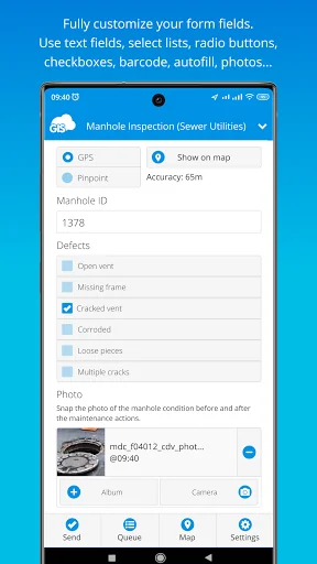
What the app looks like
Live screenshots from the Play Store, captured by our snapshot worker. Tap any image to enlarge.
Mobile Data Collection's revenue trajectory
Forecast revenue from snapshot history. Last 1 months.
Where Mobile Data Collection sits in Productivity
Revenue distribution of 35236 comparable apps. Mobile Data Collection highlighted.
Mobile Data Collection vs comparable apps
Revenue trajectory side-by-side. Bold = Mobile Data Collection, ghosted = peers.
App spec
Version
Varies with device
Last update
May 05, 2026
Launched
May 06, 2026
Price
Free
Monetization
Free
What Mobile Data Collection actually does (from store listing)
GIS Cloud Mobile Data Collection is a solution for recording and updating data in the field with mobile devices in real time, also allowing instant data access from the office. Digitize your workflow and eliminate errors and time-consuming paperwork!
The mobile app enables you to accurately record data, online or offline, by filling in digital custom survey forms. You can create an unlimited number of your own unique forms in the user-friendly form builder, in the connected web app (Mobile Da…
GIS Cloud Mobile Data Collection is a solution for recording and updating data in the field with mobile devices in real time, also allowing instant data access from the office. Digitize your workflow and eliminate errors and time-consuming paperwork!
The mobile app enables you to accurately record data, online or offline, by filling in digital custom survey forms. You can create an unlimited number of your own unique forms in the user-friendly form builder, in the connected web app (Mobile Data Collection Portal).
Continue working on your data, edit, share, and collaborate through GIS Cloud powerful web Map Editor app. Find everything you need for your workflow in one platform, no need for integrations.
Collect points, lines, or polygons! Use GPS to capture data on the go, or switch to manual and use pinpoint and drawing tools for even better precision.
Form fields are fully customizable and you can choose from text fields, selects lists, radio buttons, checkboxes, electronic signature, autofill, barcode, photo and audio, hidden fields, and much more. To control data accuracy and eliminate errors, make your form fields required, conditional (dependent on other form fields or data input), or persistent.
Manage your field staff and share projects with custom forms to field workers by assigning them the collect and update permissions, and they can instantly start collecting data in the field.
Simply sign into your GIS Cloud account (or sign up for free) and send collected data directly to your GIS Cloud app in the cloud. Data is immediately represented on a map, just click on any map feature to access collected data. Generate reports from the web app.
Access data through GIS Cloud Map Editor, where you can further edit and style your data, overlay with additional data layers analyze data, share data with colleagues with different permissions to collaborate on projects. You can also export data and much more.
Collect field data and conduct field surveys faster and easier than ever before. Start creating forms in the MDC Portal web app on https://giscloud.com and have your team out and about in a quarter of an hour!
All you need in the field:
- Offline data capture
- Offline maps
- Points, Lines, and Polygons geometry support
- Media (photos & audio) enriched location information
- QR code and barcode support
- Electronic signature
- Dropdowns, lists, input boxes, and comments based on custom forms
- Review data attributes directly in the app
- Search through data on the map
- Control different layers in the map
- Edit existing data
- Listen to audio and view images
- Real-time GPS location
- View and explore maps in the field
Prepare and analyze in the office:
- Cloud-based web apps
- Custom forms designer
- Rich GIS symbology and visualization
- Data editing and exporting
- One-click map and data sharing
- Real-time collaboration
- Map publishing
- Spatial Queries & Analysis
- Account administration
Note! This app will use GPS in the background to give you the most accurate and current location. Continued use of GPS running in the background can dramatically decrease battery life.
Comparable Android apps
The five apps in Productivity with the closest revenue to Mobile Data Collection. Click any to see its detail page.
Each forecast combines App Store rating, ratings count, monetisation model, pricing tier, IAP signals and ad-supported flag.
The base estimate is then multiplied by a per-category scaling factor learned from apps with founder-verified MRR.
Every number on this page comes from public APIs and bumetric's own snapshot history.
Full methodology covers input variables, accuracy bands per category and how we treat apps without comparable anchors.
See also the live data on Mobile Data Collection's tracker page for current rating, reviews and snapshot timeline.
Building something similar? Get a free AI audit with $-revenue forecasts for every recommendation.


 TVA Lake Info
 Quick Memo
 Orthodox Prayer in Tigrigna
 SelfM – Time Tracker & Planner
 MindBoard ( for S Pen )