What Nautical Calculators actually does (from store listing)
Nautical Calculators Preview.
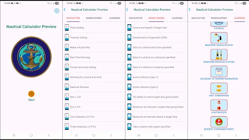
- Calculating for marine navigation, included :
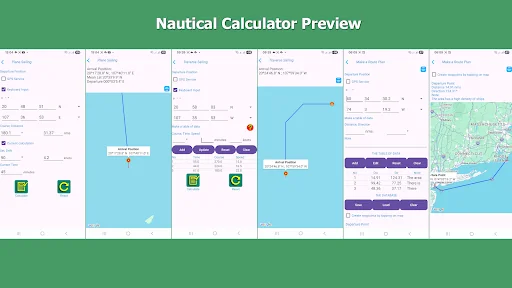
+Route Plan;
+Plane Sailing;
+Traverse Sailing;
+Current and wind sailing;
+Allowing for current and wind;
+Wheel Over;
+Meridional parts;
+Calculate true wind and apparent wind on a ship running;
+Correction of sounding;
+Additional calculations;
+Google Map and Location;
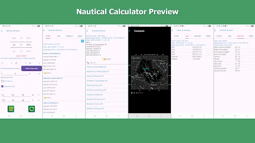
+Nautical Almanac;
+Database for Celestial LOP;
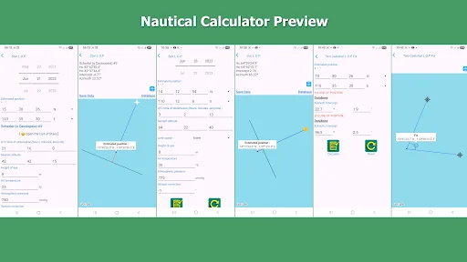
+Star and Sun LOP;
+Fix with two of LOP;
+Fix with three of LOP;
+Find the name o…
Nautical Calculators Preview.
- Calculating for marine navigation, included :
+Route Plan;
+Plane Sailing;
+Traverse Sailing;
+Current and wind sailing;
+Allowing for current and wind;
+Wheel Over;
+Meridional parts;
+Calculate true wind and apparent wind on a ship running;
+Correction of sounding;
+Additional calculations;
+Google Map and Location;
+Nautical Almanac;
+Database for Celestial LOP;
+Star and Sun LOP;
+Fix with two of LOP;
+Fix with three of LOP;
+Find the name of a star;
+Correcting marine sextant altitude of sun and stars;
+Rhumb-Line Sailing;
+Great-Circle Sailing;
+Probability Distribution Function;
+Standard deviation and error;
- Calculating for marine maneuvering, included :
+Course and speed of a target ship;
+Closest point of approach(CPA);
+Keep watch for a target ship within a range of distances;
+Data of station with time, distance and bearing specified;
+Determine the ability to reach a target ship going faster;
+Avoid collision;
+Take a station with :
-course specified;
-speed specified;
-time specified;
+ Close or open to a target ship in cases :
-as quickly as possible;
-on a constant bearing;
-with time specified;
+Maneuver to intercept a target ship running faster;
+Maneuver to intercept ahead a target ship;
+Time and Distance of intercepting ahead a target ship;
+Maneuvering with added calculating of turning;
+Close to a target ship as close as possible;
-For researching, included :
+The international regulations for preventing collisions at sea (COLREG) : Rules, Lights signs, Shapes signs and Sounds signs;
+The marine signalization : Flag signalling, Morse signalling by hand, Morse code;
+Show maritime buoyage system;
+Glossary of Marine Navigation;
+Busiest container ports;
+World lighthouses system.
-Units Conversion in Maritime
The interfaces display in two languages : English and Vietnamese.
author Vu Cong The.
vucongthe@gmail.com
Comparable Android apps
The five apps in Maps & Navigation with the closest revenue to Nautical Calculators. Click any to see its detail page.
Each forecast combines App Store rating, ratings count, monetisation model, pricing tier, IAP signals and ad-supported flag.
The base estimate is then multiplied by a per-category scaling factor learned from apps with founder-verified MRR.
Every number on this page comes from public APIs and bumetric's own snapshot history.
Full methodology covers input variables, accuracy bands per category and how we treat apps without comparable anchors.
See also the live data on Nautical Calculators's tracker page for current rating, reviews and snapshot timeline.
Building something similar? Get a free AI audit with $-revenue forecasts for every recommendation.


 Taxi Thủ Đô Sao Driver
 TrackJob
 cityflitzer freefloating
 경산버스 스마트
 Utrac Monitor