What Nautical Charts — OsmAnd actually does (from store listing)
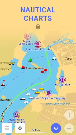
Nautical Charts — OsmAnd is an extension for OsmAnd Maps & Navigation app that provides free nautical charts for offline use. This sea map will be your reliable companion whether you are going fishing or planning a sea travel.
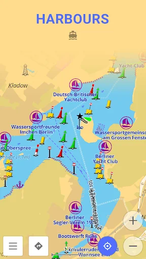
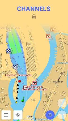
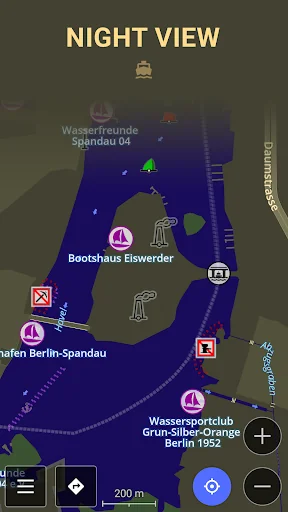
Nautical Charts are a detailed graphical representation of oceans, seas, coastal areas, and rivers. The charts can contain various information like sailing routes, navigation lights, dangerous areas, areas where it's allowed or not allowed to sail or dock, etc.
Thes…
Nautical Charts — OsmAnd is an extension for OsmAnd Maps & Navigation app that provides free nautical charts for offline use. This sea map will be your reliable companion whether you are going fishing or planning a sea travel.
Nautical Charts are a detailed graphical representation of oceans, seas, coastal areas, and rivers. The charts can contain various information like sailing routes, navigation lights, dangerous areas, areas where it's allowed or not allowed to sail or dock, etc.
These maps are also supplemented with the information about the depth contours and nautical depth points that add valuable layers of data to the map.
All the professional sailors are obliged to have official marine charts
on their ships. These charts are published by authorized agencies and cost quite some money. Agencies are investing a lot in keeping the charts up to date. They release updates for the charts on a regular basis, but because of the fact that reviewing the information and processing the updates takes quite some time, the nautical charts are never completely up-to-date.
Nautical charts by OsmAnd are based on the data from the OpenSeaMap project. The idea of the project is to build the detailed map by people who actually use it. Every user of the map can contribute by adding changes to it making it more detailed and more accurate.
While OpenSeaMap charts at the moment cannot compete with official nautical charts, they can be used by recreational sailors for orientation or route planning. This plugin does not provide nautical navigation but it is your offline reference tool that can be used together with other navigational programs.
Usage Instructions: it is highly recommended to download nautical basemap in order to see the maps regardless of detailed map presence. Nautical charts are provided as a map and a special style, to switch style in OsmAnd please use the menu item 'Configure Map' on the map screen.
Comparable Android apps
The five apps in Travel & Local with the closest revenue to Nautical Charts — OsmAnd. Click any to see its detail page.
Each forecast combines App Store rating, ratings count, monetisation model, pricing tier, IAP signals and ad-supported flag.
The base estimate is then multiplied by a per-category scaling factor learned from apps with founder-verified MRR.
Every number on this page comes from public APIs and bumetric's own snapshot history.
Full methodology covers input variables, accuracy bands per category and how we treat apps without comparable anchors.
See also the live data on Nautical Charts — OsmAnd's tracker page for current rating, reviews and snapshot timeline.
Building something similar? Get a free AI audit with $-revenue forecasts for every recommendation.

 TaiChung Bus Timetable
 TaxiF - A Better Way to Ride
 Berlin Travel Guide
 Safarway
 BusIndia.com - Official App