What PH Weather And Earthquakes actually does (from store listing)
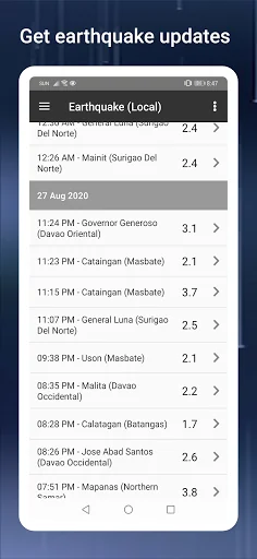
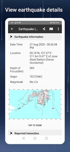
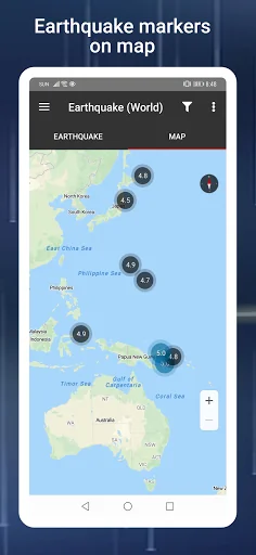
The PH Weather And Earthquakes app displays weather updates from PAGASA's (Philippine Atmosphereic Geophysical and Astronomical Services Administration) Project NOAH and earthquakes, tsunami and volcanic activity updates from PHIVOLCS (Philippine Institute of Volcanology and Seismology).
A worldwide earthquake list is also available based on data from U.S.G.S (U.S. Geological Survey).
This app was formerly known as PHIVOLCS Earthquake Alerts. The change of the app's name is important beca…
The PH Weather And Earthquakes app displays weather updates from PAGASA's (Philippine Atmosphereic Geophysical and Astronomical Services Administration) Project NOAH and earthquakes, tsunami and volcanic activity updates from PHIVOLCS (Philippine Institute of Volcanology and Seismology).
A worldwide earthquake list is also available based on data from U.S.G.S (U.S. Geological Survey).
This app was formerly known as PHIVOLCS Earthquake Alerts. The change of the app's name is important because the app now includes weather updates in the Philippines.
Other features include:
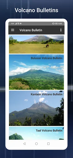
- Tsunami and volcanic activity updates.
- Weather update features include 4 hour forecast, 4 day forecast and cyclone updates (typhoon, hurricane, cylcone).
- Monitoring tools like doppler, sensors like stream gauge, rain gauge, tide level and weather station.
- Hazard maps for floods, landslides, storm surges.
- MT Satellite images and videos
- Ovitrap (dengue) reports
- Boundaries map for provincial, municipal and barangay levels
- Critical facilities listing for schools, hospitals, police stations and fire stations nationwide.
- Emergency tools like flashlight, strobe light, siren and compass.
- Twitter updates on government agencies like PAGASA, PHIVOLCS, MMDA, DPWH, NDRRMC and Red Cross.
- Weekly and hourly weather forecasts based on custom searched cities.
- Moon phase calendar including zodiac signs.
The Valley Fault System meanwhile has a visual map section and a download section with links from PHIVOLCS where users can use as reference on where fault lines are located. Both PHIVOLCS Fault Finder and LAVA (Local Active Volcano List) are also integrated.
If you have a feature you would like added, please visit the app's official Facebook page and leave a message.
Important Note: I am not affiliated with PHIVOLCS or PAGASA. The app just uses their data for most of its features.
Comparable Android apps
The five apps in Weather with the closest revenue to PH Weather And Earthquakes. Click any to see its detail page.
Each forecast combines App Store rating, ratings count, monetisation model, pricing tier, IAP signals and ad-supported flag.
The base estimate is then multiplied by a per-category scaling factor learned from apps with founder-verified MRR.
Every number on this page comes from public APIs and bumetric's own snapshot history.
Full methodology covers input variables, accuracy bands per category and how we treat apps without comparable anchors.
See also the live data on PH Weather And Earthquakes's tracker page for current rating, reviews and snapshot timeline.
Building something similar? Get a free AI audit with $-revenue forecasts for every recommendation.

 Police Tiger Robot Car Game 3D
 Limo Car Dino Robot Car Game
 Car Prado Parking Driving Game
 Погода на каждый день
 MetService NZ Weather