To help the workers of the sky!
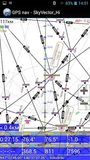
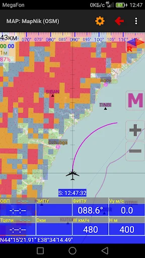
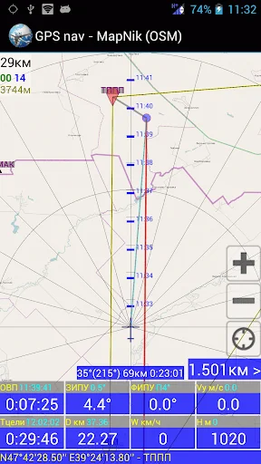
- Aviation GPS navigation;
- GPS landing.
- Calculations using GPS data.
- calculation of the flight route (IHR) according to the weather forecast.
- other aviation calculations;
- Time calculator;
- view the TAF / METAR / NOTAM reports of international airports and decode them;
- viewing of area weather forecasts.
- loading and viewing of weather maps, weather section along the route, meteor radar and satellite images;
Help file to the program: http://n…
To help the workers of the sky!
- Aviation GPS navigation;
- GPS landing.
- Calculations using GPS data.
- calculation of the flight route (IHR) according to the weather forecast.
- other aviation calculations;
- Time calculator;
- view the TAF / METAR / NOTAM reports of international airports and decode them;
- viewing of area weather forecasts.
- loading and viewing of weather maps, weather section along the route, meteor radar and satellite images;
Help file to the program: http://navair.narod.ru/download/ProNebo_Help.pdf.
Discussion at ForumAvia: http://www.forumavia.ru/a.php?a=t&id=13080.
Discussion at 4PDA: http://4pda.ru/forum/index.php?showtopic=382528.
Group VC: https://vk.com/club159833375
Comparable Android apps
The five apps in Maps & Navigation with the closest revenue to ProNebo. Click any to see its detail page.
Each forecast combines App Store rating, ratings count, monetisation model, pricing tier, IAP signals and ad-supported flag.
The base estimate is then multiplied by a per-category scaling factor learned from apps with founder-verified MRR.
Every number on this page comes from public APIs and bumetric's own snapshot history.
Full methodology covers input variables, accuracy bands per category and how we treat apps without comparable anchors.
See also the live data on ProNebo's tracker page for current rating, reviews and snapshot timeline.
Building something similar? Get a free AI audit with $-revenue forecasts for every recommendation.
 My TTC - Toronto Bus Tracker
 meterUP Parking
 실시간 지하철
 Транспортные карты Москвы
 Speedometer