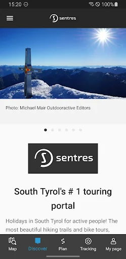
The Sentres App is the perfect companion for hiking, cycling, mountaineering and other outdoor activities. With the app you can find and plan routes around the world with ease.
Latest vector maps provide accurate information about hiking and cycling trails, via ferratas, protected areas and details about many other outdoor activities.
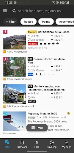
Global Trail Database:
Browse through countless route suggestions for hiking, cycling and ski touring. All routes come with full details, elevation profile…
The Sentres App is the perfect companion for hiking, cycling, mountaineering and other outdoor activities. With the app you can find and plan routes around the world with ease.
Latest vector maps provide accurate information about hiking and cycling trails, via ferratas, protected areas and details about many other outdoor activities.
Global Trail Database:
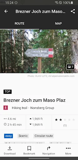
Browse through countless route suggestions for hiking, cycling and ski touring. All routes come with full details, elevation profiles, photos and directions.
Outdoor Route Planner:
Our Route Planner lets you easily plan and create routes based on your preferences. You can add text and photos to these, publish them within the Community or share them privately with friends. You can also import and export GPX files as required.
Recording your own Tracks:
The tracking function allows you to record your own tracks to include duration, distance, altitudes and an interactive altitude profile.
Smartwatches with WEAR OS from Google:
Save maps to your watch and use them offline, letting you leave your phone at home. Record tracks and upload them directly to your account. Works without a data connection
Challenges:
Join one of our walk, cycle, climb or run challenges. Pick your activity and choose the distance to complete this year.
Navigation:
The navigation function with speech output lets you navigate comfortably from A to B on all routes.
BuddyBeacon:
Safety first: Share your real-time location with friends and family.
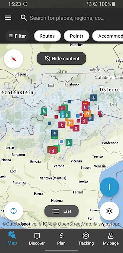
State-of-the-art map technology:
Enjoy a high-resolution display of all maps and at all zoom levels thanks to our state-of-the-art vector technology. Our digital summer and winter layers are based on OpenStreetMap and Pro and Pro+ members can also benefit from many other maps.
A Global Outdoor Travel Guide:
Helpful filters and our powerful search functions help you not only find routes, but also sights, accommodation, events and ski resorts.
A Large Directory of Mountain Huts:
Opening times, availability and prices as well as further information can all be found in our mountain hut directory. Created in partnership with the German Alpine Association (DAV), the Austrian Alpine Association (ÖAV) and the Alpine Association for South Tyrol (AVS).
Comparable Android apps
The five apps in Travel & Local with the closest revenue to Sentres. Click any to see its detail page.
Each forecast combines App Store rating, ratings count, monetisation model, pricing tier, IAP signals and ad-supported flag.
The base estimate is then multiplied by a per-category scaling factor learned from apps with founder-verified MRR.
Every number on this page comes from public APIs and bumetric's own snapshot history.
Full methodology covers input variables, accuracy bands per category and how we treat apps without comparable anchors.
See also the live data on Sentres's tracker page for current rating, reviews and snapshot timeline.
Building something similar? Get a free AI audit with $-revenue forecasts for every recommendation.

 SochiCamera Бизнес-Связь
 Meliá: Book hotels and resorts
 cab4me taxi finder
 CheckMyTrip
 땡처리닷컴 - 땡처리항공, 제주도항공권/제주렌터카 예약