What Swiss Drone Maps actually does (from store listing)
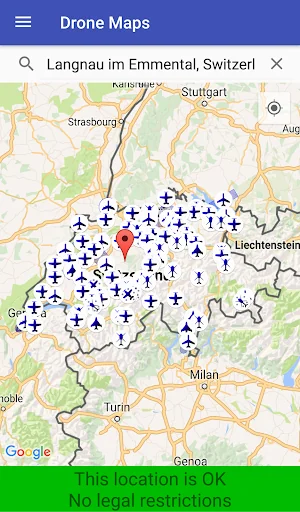
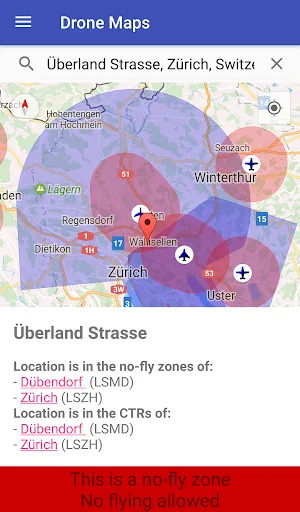
Pilots of drones and model airplanes can use Swiss Drone Maps to catch up on where they are allowed to fly. No-fly zones and controlled traffic regions are specifically coloured on the map and therefore easily visible. Airports and heliports are clearly visible thanks to intuitive markers on the map.
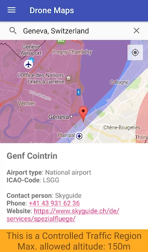
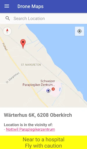
At higher zoom levels, the map shows relevant additional information such as hospital and mountain airfields. The selection of a site marker shows not only information about the area but also the…
Pilots of drones and model airplanes can use Swiss Drone Maps to catch up on where they are allowed to fly. No-fly zones and controlled traffic regions are specifically coloured on the map and therefore easily visible. Airports and heliports are clearly visible thanks to intuitive markers on the map.
At higher zoom levels, the map shows relevant additional information such as hospital and mountain airfields. The selection of a site marker shows not only information about the area but also the phone number and website of the airport. This contact data allows for spontaneous and easy applications for special flight permits.
Disclaimer: We cannot guarantee 100% accuracy or correctness and decline any and all liability. This app is privately developed. It is based on publicly available data from both government- and non-government sources (see https://opendata.swiss/de/organization/bundesamt-fur-zivilluftfahrt-bazl for details). However, the developers have neither any legal authority nor are they affiliated in any way with the swiss government (apart from paying taxes to it).
Let us re-iterate that last statement: maybe even the our dear friends at Google will understand it, then. WE HAVE NO AFFILIATION WITH THE SWISS GOVERNMENT.
Comparable Android apps
The five apps in Maps & Navigation with the closest revenue to Swiss Drone Maps. Click any to see its detail page.
Each forecast combines App Store rating, ratings count, monetisation model, pricing tier, IAP signals and ad-supported flag.
The base estimate is then multiplied by a per-category scaling factor learned from apps with founder-verified MRR.
Every number on this page comes from public APIs and bumetric's own snapshot history.
Full methodology covers input variables, accuracy bands per category and how we treat apps without comparable anchors.
See also the live data on Swiss Drone Maps's tracker page for current rating, reviews and snapshot timeline.
Building something similar? Get a free AI audit with $-revenue forecasts for every recommendation.

 滴滴司機-的士專用
 RocketRoute FlightPlan
 CDTA Navigator
 Kus buss on? (Tallinn)
 Communauto