What Tenerife Topo Maps actually does (from store listing)
Easy to use Outdoor/Offline GPS navigation app with access to the best topographic maps and aerial images for Teneriffa.
++ For offline use PRO features needed ! ++
Turn your Andoid Phone/Tablet into an outdoor GPS for trips into the backcountry WITHOUT CELL COVERAGE. This app gives you similar mapping options as you might know from Garmin or Magellan GPS handhelds.
Included FREE map layers:
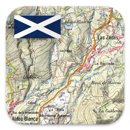
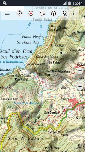
• Tenerife Topo Map: Mapa Topográfico Nacional 1:50.000 & 1:25.000 (IGN MTN25 & MTN50)
• Te…
Easy to use Outdoor/Offline GPS navigation app with access to the best topographic maps and aerial images for Teneriffa.
++ For offline use PRO features needed ! ++
Turn your Andoid Phone/Tablet into an outdoor GPS for trips into the backcountry WITHOUT CELL COVERAGE. This app gives you similar mapping options as you might know from Garmin or Magellan GPS handhelds.
Included FREE map layers:
• Tenerife Topo Map: Mapa Topográfico Nacional 1:50.000 & 1:25.000 (IGN MTN25 & MTN50)
• Tenerife Base Map: IGN Base Topográfica Nacional 1:25.000 (BTN25 & BCN25)
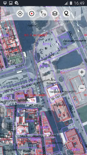
• Tenerife Imagery: High resolution aerial imagery. Plan Nacional de Ortofotografía Aérea (PNOA)
• Land Register Map: Cartografía Catastral
• AtloMaps OSM Maps with LiDAR hillshading (worldwide)
• CyclOSM maps for cycling routes
• ESRI Topographic (online access only)
• ESRI Aerial Images (online access only)
• ESRI Street Map (online access only)
• Google Road Map (online access only)
• Google Satellite Images (online access only)
• Google Terrain Map (online access only)
• Bing Road Map (online access only)
• Bing Satellite Images (online access only)
• Earth At Night
Enhance maps with additional overlays:
• Hiking, cycling, MTB, and winter sports routes worldwide
• 10 m contour lines worldwide
• Hillshade overlay worldwide
• OpenSeaMap
Main features for outdoor-navigation:
• Create and edit Waypoints
• GoTo-Waypoint-Navigation
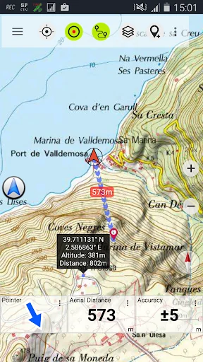
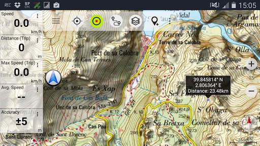
• Track Recording (with speed, elevation and accuracy profile)
• Tripmaster with fields for odometer, average speed, bearing, elevation, etc.
• GPX/KML/KMZ Export
• Search (placenames, POIs, streets)
• Customizable datafields in Map View and Tripmaster (e.g. Speed, Distance, Compass, ...)
• Share Waypoints, Tracks or Routes (via eMail, Whatsapp, Dropbox, Facebook, ..)
• Display coordinates in Lat/Lon, UTM or MGRS/USNG (Military Grid/ US National Grid)
• Record & share tracks with statistics & elevation profile
• Rotate map (Track Up & North Up)
• Get Elevation by long click on map
• Track Replay
• and many more ...
Available Pro features: (Pro features available via In App Purchase)
• Offline Use - no cell coverage needed
• Easy+Fast Bulk-download of map tiles for OFFLINE USAGE (not for Google and Bing maps)
• Create and edit Routes
• Route-Navigation (hiking & cycling profiles)
• GPX/KML/KMZ Import
• unlimited Waypoints & Tracks
• Add other Map Tile-Server
• No Ads
Offline Use:
All viewed map tiles are kept in cache. To cache large areas you need to purchase Pro features.
Use this navigation app for outdoor activities like hiking, biking, camping, climbing, riding, skiing, canoeing, hunting, offroad 4WD tours or search&rescue (SAR).
Add custom waypoints in longitude/latitude, UTM or MGRS/USNG format with WGS84 datum.
Import/Export/Share GPS-Waypoints/Tracks/Routes in GPX or Google Earth KML/KMZ format.
Preload FREE map data for areas without cell service (Pro feature !).
Comments and feature requests to tenerifemaps@atlogis.com
Have a look at our other outdoor navigation apps: https://play.google.com/store/search?q=atlogis
+++ We DO NOT track any user activities or collect any user data ! +++
Comparable Android apps
The five apps in Maps & Navigation with the closest revenue to Tenerife Topo Maps. Click any to see its detail page.
Each forecast combines App Store rating, ratings count, monetisation model, pricing tier, IAP signals and ad-supported flag.
The base estimate is then multiplied by a per-category scaling factor learned from apps with founder-verified MRR.
Every number on this page comes from public APIs and bumetric's own snapshot history.
Full methodology covers input variables, accuracy bands per category and how we treat apps without comparable anchors.
See also the live data on Tenerife Topo Maps's tracker page for current rating, reviews and snapshot timeline.
Building something similar? Get a free AI audit with $-revenue forecasts for every recommendation.
 Car Jaune
 T.A. Conductor
 SEM La Plata
 Salamanca Bus
 511PA
511PA