What TrekMe - GPS trekking offline actually does (from store listing)
<b>Explore the wilderness without limits.</b>
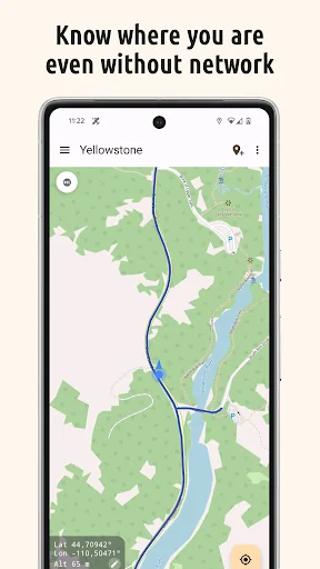
TrekMe turns your phone into a reliable, offline GPS navigator. Whether you are trekking, biking, or mountaineering, get your live position on topographic maps. Download the maps you need, and then navigate without an internet connection.
<b>🔒 100% Privacy Oriented</b>
We believe your location is your business. TrekMe features <b>zero tracking</b>. Your data never leaves your device, and you are the only one who knows where you go.
<b>🌍 Downl…
Explore the wilderness without limits. TrekMe turns your phone into a reliable, offline GPS navigator. Whether you are trekking, biking, or mountaineering, get your live position on topographic maps. Download the maps you need, and then navigate without an internet connection.
🔒 100% Privacy Oriented We believe your location is your business. TrekMe features zero tracking. Your data never leaves your device, and you are the only one who knows where you go.
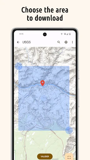
🌍 Download Offline Maps Create your own maps by selecting the area you need. Once downloaded, they are available completely offline—perfect for dead zones.
• Supported Sources: USGS, OpenStreetMap, SwissTopo, IGN (France and Spain).
• Storage Friendly: Save heavy maps to your SD card to free up internal memory.
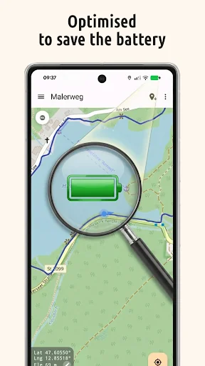
🔋 Built for Endurance Don't worry about your battery dying mid-hike. TrekMe is engineered for efficiency, ensuring fluid performance with ultra-low battery usage.
Key Features • 📍 Navigation: View your live position, orientation, and speed.
• 👣 GPX Manager: Import, record, and share tracks in GPX format.
• 📈 Real-time Stats: Visualize distance, elevation, and speed while recording.
• 🖍️ Markers: Add POIs (Points of Interest) with comments and photos on the map.
• 📏 Planning: Create tracks manually and measure distances between points.
🚀 Unlock Premium Take your adventure further with advanced tools:
• Safety Alerts: Get notified when you stray from your track or approach specific locations.
• Unlimited Maps: No size limits for map downloads.
• Pro Tools: Edit tracks (split/merge), fix missing map tiles, and access HD OpenStreetMaps.
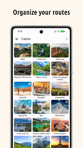
• Organize Limitlessly: Create unlimited folders to perfectly structure and manage all your recorded tracks.
• Official French Topo Maps: Access the gold standard for hiking in France (IGN).
📡 For Professionals & Enthusiasts Need high-precision data? Connect an external Bluetooth GPS(*) to TrekMe.
• Bypass internal GPS for higher accuracy.
• Ideal for aeronautics, professional topography, and high-frequency location updates.
(*) Supports NMEA over Bluetooth
User Guide & Support https://github.com/peterLaurence/TrekMe/blob/master/Readme.md
Comparable Android apps
The five apps in Travel & Local with the closest revenue to TrekMe - GPS trekking offline. Click any to see its detail page.
Each forecast combines App Store rating, ratings count, monetisation model, pricing tier, IAP signals and ad-supported flag.
The base estimate is then multiplied by a per-category scaling factor learned from apps with founder-verified MRR.
Every number on this page comes from public APIs and bumetric's own snapshot history.
Full methodology covers input variables, accuracy bands per category and how we treat apps without comparable anchors.
See also the live data on TrekMe - GPS trekking offline's tracker page for current rating, reviews and snapshot timeline.
Building something similar? Get a free AI audit with $-revenue forecasts for every recommendation.
 Pakrism
 Cat in a Flat: Cat Sitter
 Øresundsbron
 Field App
 Toosla - rent a car in France